Services
What We Provide
Brownfields
Brownfields Locations
Brownfields - Big Cypress
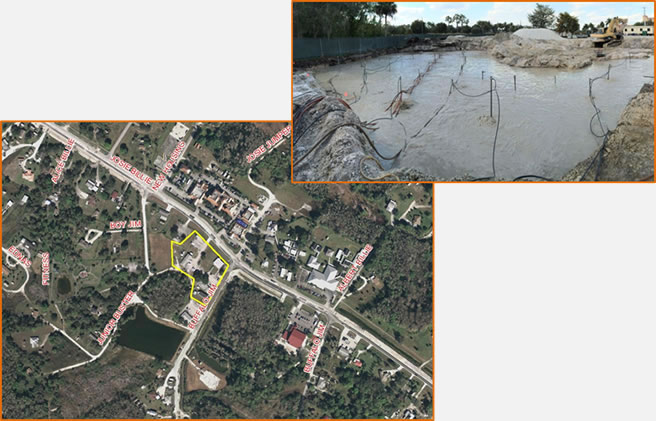
Location: 31055 Josie Billie Hwy, Big Cypress Reservation, Hendry County, Florida
Geographic Info-Lat/Long: 26.31773056 / -80.99027778
Area: 2.67 acres
Site Information: Unconfirmed information from interviews revealed the site was historically the location of a fire or a police station. During excavation for construction of a new medical center in 2015, petroleum odors from the soil prompted delay in construction. Soil analysis revealed heavy soil contamination from petroleum-based products. Over two months of soil and groundwater remediation through air sparging and soil removal was performed to attain cleanup target levels. A vapor barrier was installed over the contaminated area and the new building pad before resumption of the clinic construction. The new medical clinic is now complete. Regular monitoring of the site by soil and groundwater sampling are next courses of action for this site.
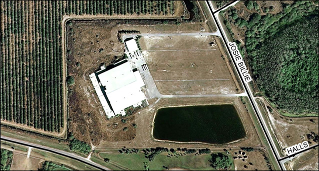
Location: Northwest intersection of County Road 833 and West Boundary Road, Hendry County, Florida
Area: Approximately 22 acres
Site Information: This site was originally utilized as farmland prior to the development as a commercial Bingo Hall in 1987. The Bingo Hall operated for 10 years before becoming a sporadic solid waste dumping area. The Seminole Tribe of Florida (STOF) completed both Phase I and II Environmental Site Assessments (ESA) to determine the presence of contaminants. Soil remediation activities were conducted after it was found that there was a leak of petroleum on the site. Groundwater assessment was not performed at that time and will need to be completed in the future.
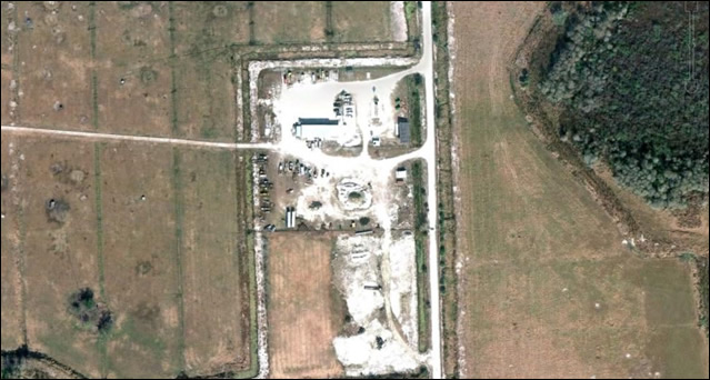
Location: Approximately 1000 feet south of the intersection of County Road 833 and Herd Development Road, Hendry County, Florida
Area: Approximately 11.5 acres
Site Information: Prior to development of the site in 1992 and 1993 the land was utilized for agriculture practices. The site is currently subdivided into two fenced compounds (east and west) located in the north portion and an undeveloped heavily vegetated section (south) which is used to store equipment. Multiple above ground storage tanks (ASTs) and vehicle maintenance wastes have been left on site. Phase I/II Environmental Site Assessment (ESA) have been performed.
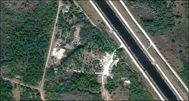
Location: SW side of Bureau of Indian Affairs (BIA) Highway 1280 and the L-28 Interceptor Canal, Hendry County, Florida
Area: 37 acres of partially developed land
Site Information: This site remained undeveloped land until 1995. Currently several small structures are on site including a pump house and water treatment facility. The site was formerly used for the processing of game meat; however, the game meat processing plant and wastewater treatment plant are currently unused. The site currently houses offices, a maintenance area, camp sites, cabins, and a shooting range. A Phase I Environmental Site Assessment (ESA) has been performed on the property and recognized environmental conditions were noted. Further remediation work is needed and planned for this site.
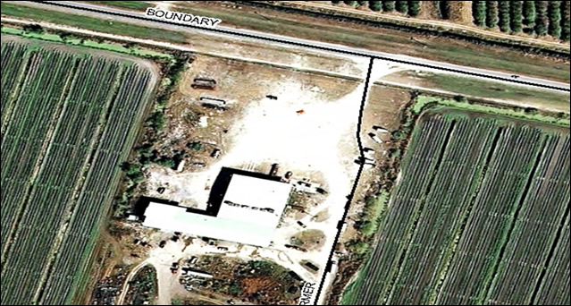
Location: Approximately 3/4 miles west of County Road 833 and West Boundary Road intersection, Hendry County, Florida
Area: The entire farm is approximately 904 acres including farm fields and undeveloped native areas (mostly cypress domes). The Brownfield site consists of approximately 3.2 acres around the packing house.
Site Information: From the early 1930s or early 1940s until 1982 this site was utilized as pasture land. In 1983, the Seminole Tribe of Florida (STOF) began vegetable farming operations on the property. The Brownfield site consists of the Seminole Farm’s maintenance area. A Phase I Environmental Site Assessment (ESA) was performed on site and several recognized environmental conditions (REC) were identified including a chemical storage, a wash down area and sink, agricultural and commercial dumping, above ground storage tanks (ASTs). Numerous unlabeled 55-gallon drums and 5-gallon containers were also identified. A Phase II ESA was completed in 2011-2012 on the area of the packing house. Several areas of contamination were found and will need to be further assessed.
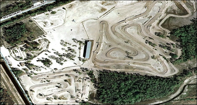
Location: West Boundary Road approximately 3.61 miles west of Josie Billie Highway Road, Hendry County, Florida
Area: The entire site consists of 90 acres of partially improved property.
Site Information: Prior to the construction of the motocross in 2002 the site was vacant undeveloped land. The property included four motor cycle race tracks, a metal grand stand structure, a parts storage shed, a residential trailer, an office trailer, an entrance shed, four storage containers, a cell tower and several Chickee huts. Most of these improvements have been removed and the fill for the motorcycle race tracks have been mostly removed since the suspension of racing activities. A Phase I Environmental Site Assessment (ESA) has been completed in 2010. No environmental conditions were found or reported. No further action is warranted at this time.
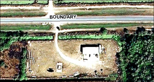
Location: South Boundary Road, Hendry County, Florida
Area: Approximately 5.5 acres
Site Information: Prior to development of the site the land was heavily wooded and vegetated. A vehicle maintenance shop was constructed and maintained between 2001 and 2003. The maintenance shop consisted of a 7,500 square foot building that is no longer in use. A Phase I Environmental Site Assessment (ESA) documented above ground storage tanks (ASTs) and vehicle maintenance wastes on site. A Phase II ESA performed analytical laboratory analysis of soil samples which confirmed petroleum contamination on site. Preliminary remediation has been completed. However, future groundwater and soil testing may be required which may result in further remediation.
Brownfields - Brighton
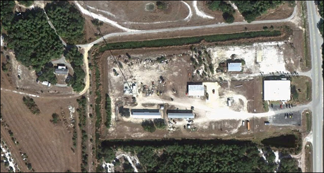
Location: Off of West County Road 721 and just west of Cattle and Land Operation building, Glades County, Florida
Area: Approximately 0.5 acres
Site Information: This site remained undisturbed until 1986 with the construction of the current Land and Cattle building. In 1988 the area was utilized as a storage facility for agrochemicals and equipment. A Phase I /II Environmental Site Assessment (ESA) have been performed on site. The site is currently fenced off from public access with a 6 foot chain link fence. Further corrective actions will be completed as necessary.
Brownfields - Hollywood
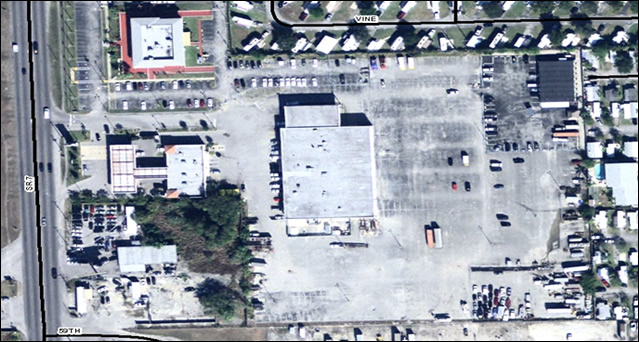
Location: 3101 State Road 7, Broward County, Florida
Area: Approximately 3 acres
Site Information: This site was formerly used as an automotive sales and service facility (Ford dealership/maintenance). There are extensive associated parking areas to the east and smaller parking areas in the north, west and south. There were hydraulic lifts on the site that required a large amount of hydraulic fluid in underground storage vessels under each lift. Over the years the underground storage vessels have leaked.
A portion of the site was cleaned up in 2012 when the Tribe’s Fire Rescue Department moved into the building. The majority of the lifts have been removed. However, the underground storage was left in place. Phase I and II Environmental Site Assessments (ESA) have been completed on site. In 2011, the northwest portion of the automotive sales/service facility building was assessed for potential hydrocarbon contaminants associated with the construction activities for a new fire station. No contamination was observed in the assessed area. However, additional assessments will have to be accomplished to define the total extent of contamination to the entire site and remediation may be required as necessary.
Brownfields - Cattle Dip Vats
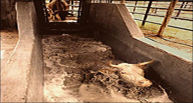
Cattle Dip Vats were constructed beginning in 1910 as a federal mandate to eradicate cattle tick fever that started entering Florida in the early 1900s. Cattle were corralled and run through concrete dipping vats filled with a solution containing arsenic, DDT and other organochloro pesticides. The program was terminated in the late 1960’s when it was believed that cattle tick fever was eradicated. Some of these structures remain in place where the toxic solution may impact both the soil and groundwater. There are eight known CDVs throughout The Seminole Tribe of Florida’s (STOF) Tribal Lands. Remediation of these sites has been underway to protect both the health of the environment and the surrounding population. A list of CDV sites are listed below:
- West Feeder CDV (Big Cypress Reservation)
- Bull Pasture CDV (Big Cypress Reservation)
- Tucker Ridge CDV (Brighton Reservation)
- Cotton CDV (Brighton Reservation)
- Johnny Bow Legs CDV (Brighton Reservation)
- Red Barn CDV (Brighton Reservation)
- Marsh Pens CDV (Brighton Reservation)
- Food Bank Cowpens CDV (Big Cypress Reservation)
For additional information pertaining to CDVs please contact the Seminole Tribe of Florida. Environmental Resource Management Department at 954-965-4380.
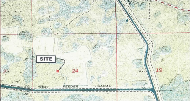
Location: Remote wooden hammock south of County Rd. 833, Hendry County, Florida
Area: Less than 1 acre.
Site Information: The West Feeder CDV’s concrete structure was removed in 2006 and disposed of properly. Additional soil and groundwater testing of the site was performed by a Phase II Environmental Site Assessment (ESA) in 2007 and warranted additional source removal activities of contaminated soils. Contaminated soils were successfully removed and disposed of properly in 2009. To determine the groundwater quality in the area where the soils were excavated, in January 2012, ERMD personnel coordinated and supervised the installation of five monitoring wells for assessment of the groundwater. The assessment which included the collection of groundwater samples and analysis of parameters of concern such as arsenic and organochlorine pesticides indicated that concentrations of these parameters did not exceed the Florida Department of Environmental Protection (FDEP) Groundwater Cleanup Target Levels. The results of the assessment indicated that the soil remedial activities conducted in 2009 were successful in mitigating not only the impacted soils but the source for groundwater contamination. Based on the soil remediation and results of the groundwater assessment, no further remediation activities are warranted at this time.
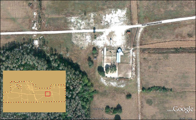
Location: Along Herd Improvement Road, south of Snake Road, Hendry County, Florida
Area: Less than 1 acre
Site Information: Historical records of the Bull Pasture indicate that a former CDV may be located at this project site. In 2011, a geophysical investigation was completed using ground penetrating radar (GPR) to determine the possible presence and location of the former CDV. The geophysical investigation could not determine the CDV location within the surveyed area of the project site. In September of 2011, the Environmental Resource Management Department (ERMD) conducted a soil assessment in the surveyed area encompassing the existing cow pen in an effort to determine the soil conditions and if possible, the location of the CDV. The soil assessment encompassed the advancement of borings and analysis of soil samples for arsenic. Based on the laboratory results which indicated that just three locations showed concentrations of arsenic above background levels, In January 2012, ERMD conducted a groundwater assessment to determine the groundwater conditions in these areas. Groundwater samples collected and analyzed for arsenic and organochlorine pesticides did not reveal the presence of these contaminants. Based on the results of the soil and groundwater assessment, no further action can be completed at this time unless new information becomes available as to the location of the CDV.
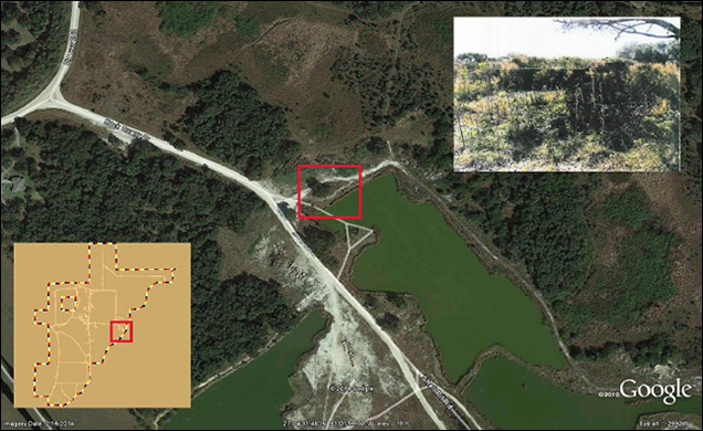
Location: Northeast corner of the Brighton Reservation Glades County, FLEast corner of the Brighton Reservation, Glades County, Florida
Area: Less than 1 acre.
Site Information: The Tucker Ridge CDV is located in a shell rock quarry that is currently active. The CDV was initially identified by degradation of vegetation both in and surrounding the dip vat. Since the initial identification, the CDV has been removed and properly disposed of. Soil and groundwater samples have been analyzed to determine the impacts of arsenic and organochlorine pesticides. Removal of contaminated soil was completed in 2004 and disposed of properly. The Tucker Ridge CDV was backfilled and leveled. No further action is warranted at this time.
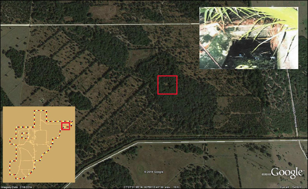
Location: Remote wooden hammock, NE corner of reservation, Glades County, Florida
Area: Less than 1 acre.
Site Information: The Cotton CDV is located in a remote wooden hammock surrounded by palmetto trees. In 2004, the CDV was removed and disposed of properly. Soil and groundwater samples have been analyzed to determine the impacts of arsenic and organochlorine pesticides. Additional soil and groundwater testing was completed in 2013. Proper removal and disposal of contaminated media will occur in 2015.
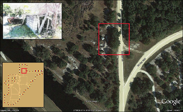
Location: West side of BIA Highway 283, Glades County, Florida
Area: Less than 1 acre.
Site Information: The Johnny Bow Leg’s Pasture CDV was removed and properly disposed of in 2004. Soil samples have been analyzed to determine the impacts of arsenic and organochlorine pesticides. Based on the analytical laboratory results no further remediation actions are needed for this site.
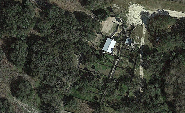
Location: Approximately 2.5 miles due west of County Road 721 (Reservation Road), Glades County, Florida
Area: Less than 1 acre.
Site Information: The original CDV was found and the structure was removed in 2003. Preliminary assessment was completed in 2012 and it was found that both soil and groundwater contamination existed at the site. A limited site assessment completed in 2014 found environmental impacts to the groundwater and soils. Based on these assessments findings, further sampling, delineation and analysis will need to be performed on this site.
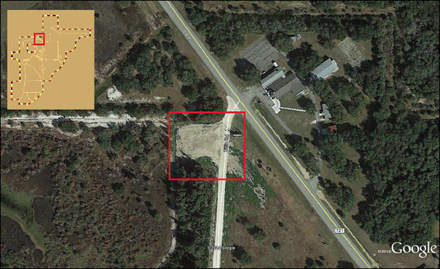
Location: Approximately 100 feet west of County Road 721 (Reservation Road) immediately south of the northern entrance to the Brighton Reservation in Glades County, Florida
Area: Less than 1 acre.
Site Information: An Environmental Site Assessment was performed on the Food Bank Cow Pens CDV in 2004. Source removal activities that included groundwater removal occurred in 2013. At this time groundwater monitoring wells were installed. Those wells were sampled in 2014 and were found to be above FDEP clean-up target levels. Further soil sampling may be warranted and groundwater remediation will be required for this site.
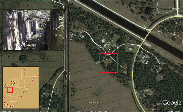
Location: Approximately three miles west of County Road 721 (Reservation Road) on Harney Pond Road in Glades County, FL. Site is located 600 feet west of Harney Pond Road immediately south of Harney Pond Canal off Madison Nenuce
Area: Less than 1 acre.
Site Information: The Red Barn Brownfield site consists of a CDV and a pole barn which served as a Drum Staging Area. The former Drum Staging Area included two permanent structures; a pole barn and a concrete block structure equipped with an above ground storage tank (AST) and underground storage tank (UST) for vehicle fueling. In 1999, the discarded drums and petroleum storage tank were removed and disposed of properly. Analytical laboratory results of soil and groundwater samples were performed within the immediate vicinity of the former Drum Staging Area.
In 2004, the CDV’s sludge and concrete structure were removed and disposed of properly. Soil and groundwater samples have been analyzed to determine the impacts of arsenic and organochlorine pesticides within the immediate vicinity of the CDV. A groundwater pump and treat system was installed in 2008 to remediate the arsenic in the groundwater. Water restrictions have been implemented on the two properties surrounding the Red Barn Brownfield site. These sites are now serviced by the local water utility and no use of irrigation or drinking water is permitted from on-site wells. Source removal at the site was conducted in 2012. Groundwater monitoring wells were reinstalled. The wells have been sampled since that time and then show that the levels of arsenic in the groundwater are still well above the FDEP clean-up target levels. A pilot study for in situ remediation of arsenic in groundwater is planned to be conducted in 2015.
- Ah-Tah-Thi-Ki Museum
- Aviation Department
- Broadcasting Department
- Brownfields
- Center for Behavioral Health
- Education Department
- Emergency Management
- Environmental Resource Department
- ERMD Wildlife
- Executive Administrative Office
- Gaming Commission
- Health and Human Services
- H.E.R.O. - Heritage and Environment Resources Office
- Housing Department
- Native American Travel
- Native Learning Center
- Seminole Boys and Girls Club
- Seminole Media Productions
- Seminole Police Department
- Seminole Fire Department
- Solicitation to Bid
- Tribal Inspector’s Department
- Tribal Community Development
- Tribal Historic Preservation Office
- Tribal Library Program
- Veteran’s Building
Helpful Links
Contact Us
6300 Stirling Road
Hollywood, Florida 33024
Phone: (800) 683-7800
Copyright © Seminole Tribe of Florida